My grade-high school friends and I went on a hike and draw session on Maundy Thursday. Nature, walking, and art -- it was our attempt to blend our passions in one day trip.
This was a DIY trip wherein we went to the jump off point, paid registration and guide fees by ourselves. Mt. Balagbag is located in San Isidro, Rodriguez, Rizal which is around an hour away from Cubao, QC. Fun fact: the jump of point can be pinned through Grab, so this could be an option if you'd like to take a chance on booking... ;-) otherwise, there are many blogs sharing how you can commute there which you may read here, here, and here.

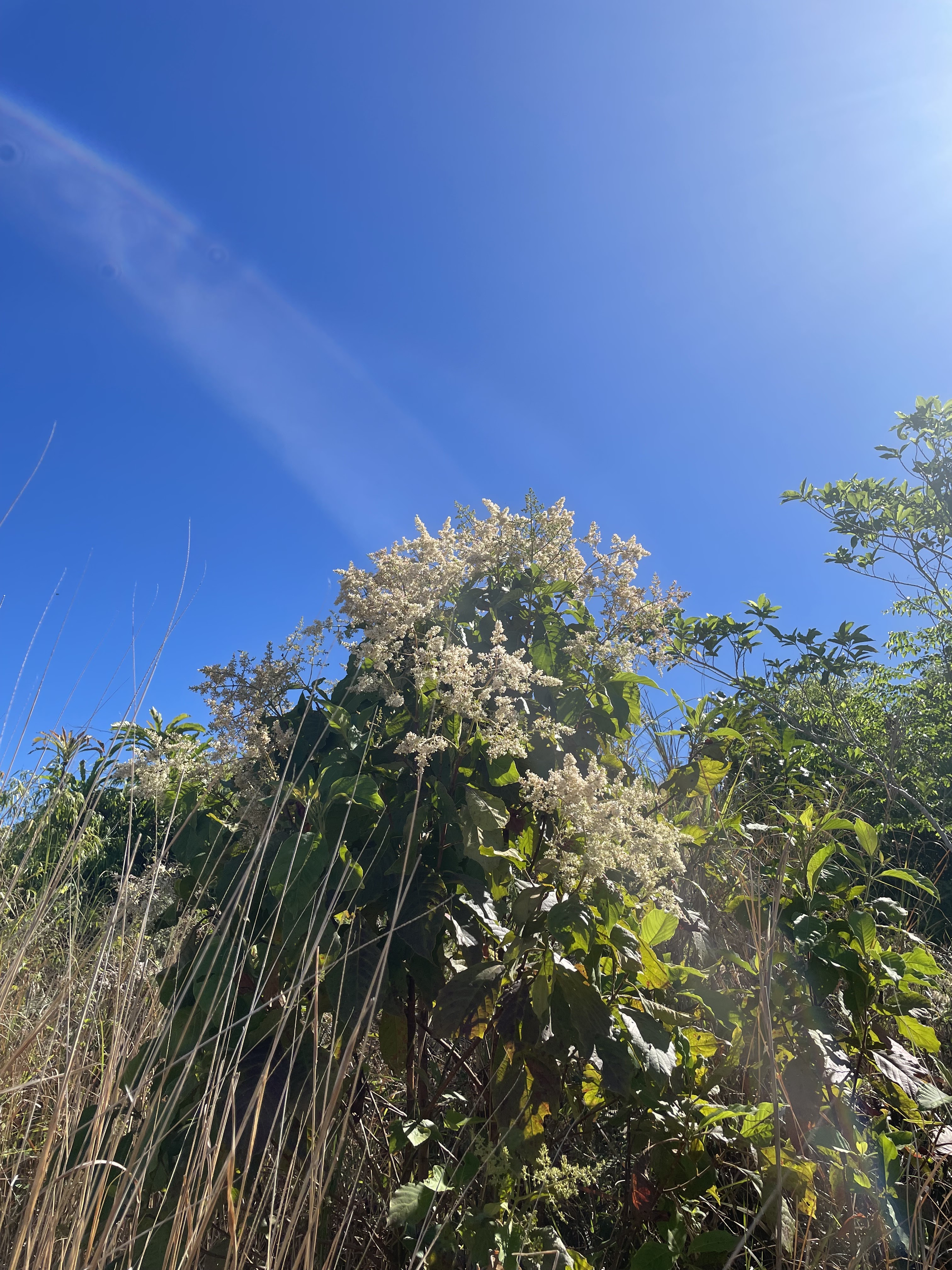
Mt. Balagbag is perfect for beginner hikers since the trail is wide and it's straightforward. It is rated as 3/9 by Pinoy Mountaineer (but feels like a 2). The only challenge I could think of would be tripping from rocks (since the trail is a rough road) or getting a heatstroke because there aren't any trees. There weren't any forests to shade us from the sun; we were just surrounded by tall grass. I would recommend going here early in the morning, perhaps around 6:00AM. We started our hike late at around 8:00AM, so the sun was very much shining as bright as it can right above us.
We paid 80 pesos each for the first registration at the jump off point. We were advised that we needed to pay 100 pesos each when we reach the second registration which we would pass by midway through our hike. The land going up to the summit is privately owned, apparently. The guide fee is 350 pesos which we split between the 4 of us.


Trail runners and bikers breezed past us on our way to and going down from the summit. The trail is so wide, a 4x4 vehicle can definitely go up through here. I admired the trail runners though, how fast they ran up and down the trail. I consider it to be a challenge to decide where you'll be stepping; you'll need to have quick reflexes and decisive mind in order to run through the trail. Even I find myself challenged to think about where to step next as I walk up the hill.
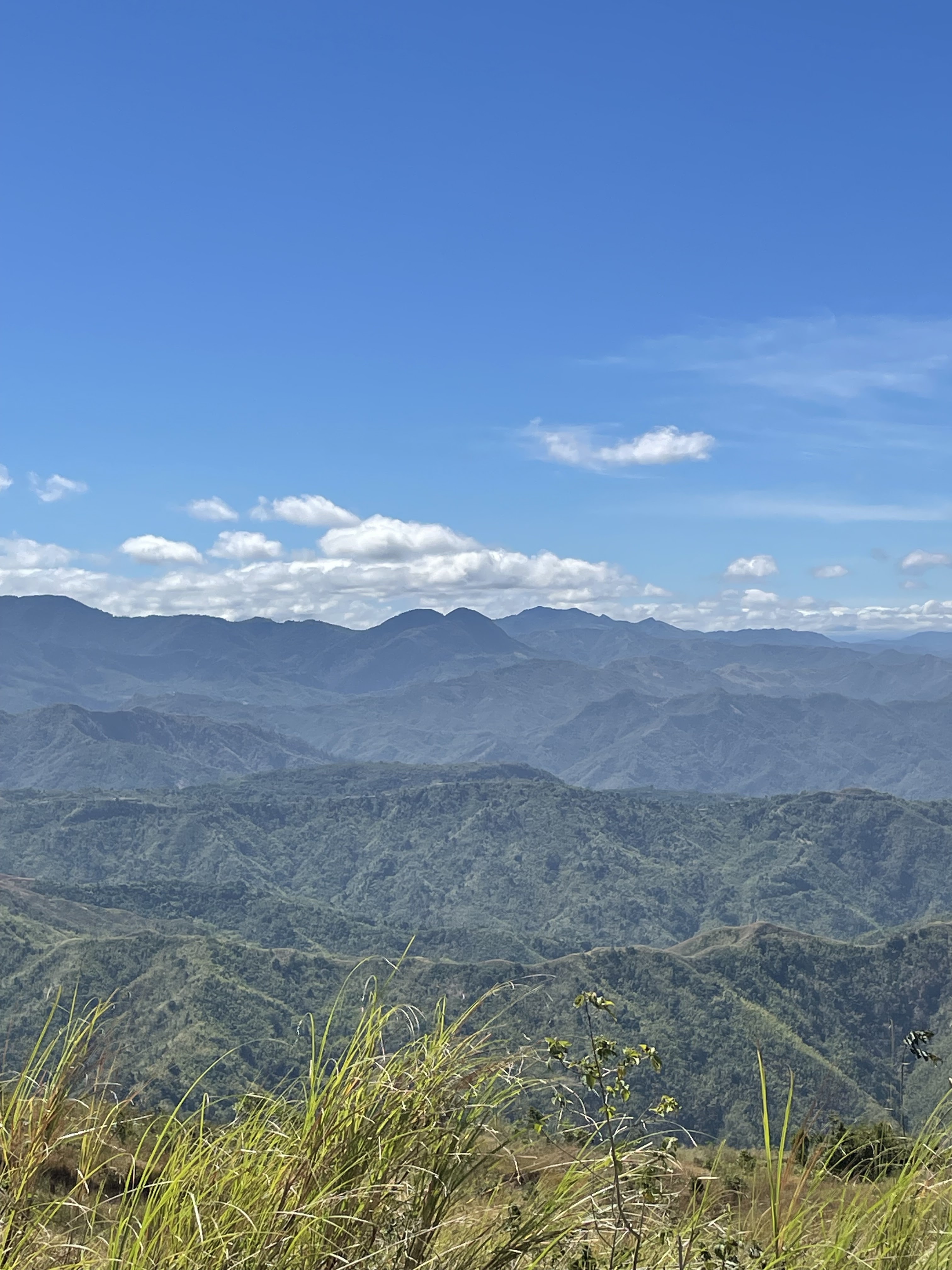
Mt. Balagbag Summit (775+ MASL)
We arrived at the summit at 9:30AM. It took us roughly only 1 hr and a half to reach the summit! Whatta feat. The long stretch of the Sierra Madre mountain ranges was breath-taking. I had another moment wherein I had to embed the scenery into my brain. My friends and I also sketched the scenery for better memory retention. ;-) but really, I think with my friends, we always try to squeeze in an opportunity to make art during our hangouts, which I really love and appreciate.
|
| The view I have embedded in my mind |

 |
| Our drawings! |
 |
| My drawing, which I will watercolor at home |
We chatted with our guide Joan throughout the hike. She shared that there used to be a lot of trees in the area and there were also streams of water. Unfortunately illegal logging happened and the streams eventually dried up. There is also a trail leading up to the Maranat waterfalls, although it is closed at the moment. It's a sad reality when we interfere with nature.. there will always be consequences, but I'm hopeful that it will heal by itself through time. We just need to be conscious and do our part as well to be responsible whenever we're out in nature. Keep your trash, take nothing but photos, respect wildlife big or small.. all these reminders may sound cliche but it surely has a big impact.
The descent was much faster. We took an alternate route which was considered a shortcut although it had a lot of turns but much shorter compared to the one we used going up. It was a lot more scenic for sure, and it was easier to go down here since there were actual steps and not just a straightforward rough road.


There comes a point in time in the descent though.. that I feel like it lasts forever and my feet are craving to walk on flat land again. Happy to share though that once we got back on flat land, we treated ourselves to a 50 pesos mango shake!! Small but certain happiness :-) We finished the hike by 11:00AM.


Learnings from this hike:
♡ Bring an umbrella and pack lots of water because it can get really hot since there aren't much trees.♡ Best time to go here is early in the morning or late in the afternoon to avoid the sun.
♡ Despite the scorching heat, I actually prefer this over a rainy hike. The scenery is a lot better, there's a guaranteed clearing when you reach the peak, and the trail is not slippery. Plus the hike becomes a lot harder when it rains, so I'd rather endure the sun.
♡ Speak and interact with the guide and locals as much as you can. There's much to be learned and lots of stories to exchange, and it makes the hike all the more enjoyable because of new connections made however fleeting it may be.
It's already summer time here in my side of the world. Hope you're staying cozy and hydrated, dear reader <3
Amazing Hike and Photos👍
ReplyDeleteVery informative and insightful for beginner hikers , like me 😁
Thanks, Panda! ;) I'm glad this guide is helpful for you!!
Delete